Chang Guang Satellite Technology Co., Ltd.
satellite communication companies
CGSTL was founded in December 1st, 2014, it is the first commercial remote sensing satellite company in China. Serving 7 billion people on the globe with the remote sensing information product is our ultimate goal.
Read More Satellite Product
satellite communication service
WHO IS CGSTL

CGSTL (Changguang Satellite Technology Co., Ltd) is the first commercial remote sensing satellite supplier in China. Now, CGSTL has set up a commercial business dealing with the development and operation of commercial satellites as well as remote sensing information processing all in one.

Read More

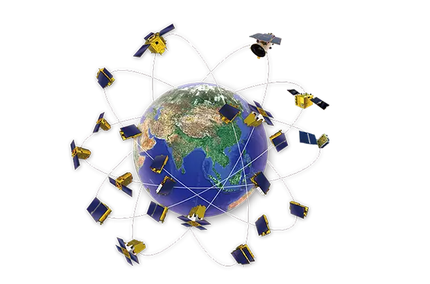
changguang Jilin 1 satellite constellation is the core project under construction by CGSTL. The first phase of the project consists of 138 high-performance optical remote sensing satellites covering video, high resolution, wide band, infrared, multispectral and other series. At present, CGSTL has sent 73 Jilin-1 satellite constellation networking remote sensing satellites into the designated orbit through 19 launches (of which, SP04 has been retired on August 31, 2022). Up to now, Jilin-1 satellite constellation has 72 in orbit remote sensing satellites, and has built the world's largest sub meter commercial remote sensing satellite constellation.

WHO IS JL1
Massive Satellite Data

Based on JL1 constellation, Changguang have massive satellite data covering the world and revisit any place in the world 23 to 25 times a day.

Competitive Imagery Products

Changguang have competitive imagery products in various panchromatic resolutions such as 0.5m, 0.7m, and 1m. In addition, multispectral/video/luminous/stereoscopic/

inertial space and other value-added products are also provided in our supplements.


Convenient Purchase Methods

Changguang provide convenient purchase methods. You can see the world from the perspective of space in exceptional price.

Get Planetary-scale Inspiration, Creating a Searchable Earth
Relying on the advantages of increasing number of Changguang JL1 satellites, the satellite data and its products have the characteristics of strong coverage, high cost performance, abundant amount of archived data, customizable shooting demand, flexible programming service and short delivery time, etc.
  • Satellites Data
  • Satellite Remote Sensing
  • Satellite Ground Systems
Changguang company can develop and produce the hardware used in the satellite manufacturing process such as satellite products, carrying platform, satellite cameras and satellite standalone product, satellite components product.
Testing service is a necessary step to confirm the validity of satellite before it is put into application such as optical manufacture, satellite testing, customized Service.
According to the calculation of the existing satellites in orbit, JL1 satellite constellation can visit anywhere in the world 23 to 25 times a day, with the ability to photograph a global twice a year and a national six times a year. The resolution with 50cm imagery and the swath with more than 150km imagery is revealing the changes of the world far better than before.
satellite services company
Record the beauty of the world from the past to the future captured by JL1 constellation.
Read More
Theme Collection Satellite Imagery
Volcano, parks, deserts, fields, etc. Catch all the world's beautiful sceneries in JL1 Theme Collection.
Read More
International Hot Spot Satellite Imagery
See what is happenning now in the world and know how it is changing your life.
Read More
aerial and satellite services
Massive satellite imagery data in both daily archived or task programming is changing the way you see the world.
Contact us
CubeSat (Cube Satellite): A New Solution for Deep Space Exploration
Nov 05, 2024
CubeSats (cube satellites) are a type of small satellite widely used in universities globally for space science research and education. They feature low cost, high functionality density, short develop...
Characteristics and Applications of CubeSat Infrared Cameras
Nov 01, 2024
The CubeSat infrared camera is a specialized infrared imaging device designed for use on CubeSats. A CubeSat is a type of small satellite characterized by its modular design, with a standard size unit...
Satellite Ground Systems: "Nerve Center" of Earth Observation Satellites
Oct 26, 2024
During the process of using remote sensing technology and equipment to observe surface cover and natural phenomena by remote sensing satellites, the positions on Earth where the satellite observes, th...