English
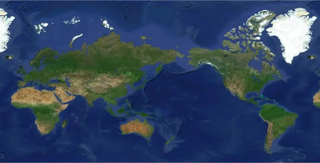
Recently, the high-definition remote sensing map taken by "Jilin-1" satellite, known as "One Map of the Globe", was released in Changchun, Jilin. This map can provide global high-definition satellite remote sensing data and application services for users in various industries, promoting the high-quality development of industries such as agriculture, forestry and water resources, natural resources, and financial economics. Its resolution, timeliness, and positioning accuracy indicators have reached the international leading level.

The "One Map of the Globe" released this time was produced from 1.2 million selected images out of 6.9 million images from "Jilin-1" satellite imagery based on satellite image processing techniques. The map covers a cumulative area of 130 million square kilometers, achieving sub-meter-level image coverage of global land areas except for Antarctica and Greenland.
More than 90% of the images used in the "Jilin-1" One Map of the Globe are 0.5m resolution images, with over 95% single-year image coverage, and overall cloud cover is less than 2%, balancing high spatial resolution, high temporal resolution, and high coverage rate.
With features such as high image quality, fast update speed, and wide coverage, the "Jilin-1" One Map of the Globe can be applied in various fields like environmental protection, forestry supervision, and natural resource investigation, playing a significant role in building a refined remote sensing application service system.
The research and development team overcame key technologies such as intelligent data screening for multiple coverages, large-area geometric correction, and apparent consistency processing, deeply integrating large-area satellite data production and cluster scheduling, improving production efficiency by 60% compared to traditional methods, ensuring the production rate and image quality of the "Jilin-1" One Map of the Globe.
On October 7, 2015, China's first commercial high-resolution remote sensing satellite independently developed by Chang Guang Satellite Technology Co., Ltd. – the "Jilin-1" satellite, was successfully launched. Today, the "Jilin-1" constellation has 108 satellites in orbit, forming the world's largest sub-meter-level commercial remote sensing satellite constellation, providing a vast source of high-definition satellite remote sensing data for the annual update of the "Jilin-1" One Map of the Globe.